|
|
|
Data Conversion
Each record of the source data file looks like this:
8600018750      -8600   18750   0       0.122   0.226   0       2.491   2.552
170     0.32    2725.727        2895.727        2896.047
-
- Field extraction from source data file.
- The first stage in preparing the data for visualization is to run the source text file through "awk" and strip off the first field, the cell id. The remaining fields are:
- The x coordinate in plan view of the "sample".
- The y coordinate in plan view of the "sample".
- Protore grade.
- Leach zone grade.
- Blanket grade.
- Protore density.
- Blanket density.
- Leach density.
- Thickness in meters of the enrichment blanket.
- Thickness in meters of the leach cap zone.
- Bottom of blanket (meters).
- Top of blanket (meters).
- Elevation in meters of topography.
The values in the datafile represent how things are today. The assumption
in building the horizon evolver is that once upon a time, the horizons
are all at the same depth, namely at the level of the topography, and
that hydrogeologic and chemical forces over time have resulted in the
existing three-layer model.
-
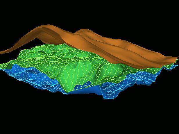
- Krige the data, producing a structured mesh.
- Continuing, the next stage in the process of preparing data for visualization was to generate structured 2d meshes for each of the contact layers. This was necessary because the source data file is "randomly sampled," including "holes" in the data. A two-dimensional kriging operation was performed on each of the contact layers. The formula used in kriging is an inverse-distance linear combiner, so that points far away from the computed grid point have little, if any, influence, and points nearer the computed grid point have more influence.
- Time-based evolution using parametric interpolation of horizon depth.
- Once we have structured grids for each horizon, it is a simple matter to perform visualization and interpolation. We assume that the depth of the top and bottom of the enrichment blanket to be identical to the level of the topography at time zero, and that they move linearly in depth as a function of time to their present-day depths.